Many say the "middle of winter" is on Groundhog Day (February 2). In 2026, the midpoint between winter solstice and spring equinox fell on February 3. But why quibble over one day, it's all good weather from there, right? Not so fast...
Weather
Weather-related information, including monthly climate summaries for New Brunswick as compiled by Environment and Climate Change Canada.
Weather Net to start season on November 3
Hey, weather watchers! Dust off those snow boards, metre sticks and thermometers, because the IRG Weather Net will start for the 2025-2026 season on Monday, November 3, 2025, and run every morning at 7:30 a.m. Atlantic Time. Net control will be shared by Rick VE9MTB and Scott VE1CSA. They will gather your local observations and send them off to Environment and Climate Change Canada. ECCC uses the reports to fine tune their predictions and issue alerts in severe weather conditions. The reports are also used by other agencies such as River Watch and news media.
Radio net frequencies for hurricane activations
Hurricane Melissa update: Stations outside the affected area that do not have relays into the affected area who would like to listen into the VoIP Hurricane Net can use any of the following systems for listen-only purposes and can connect on either Echolink or IRLP: *NEW-ENG3* Echolink conference node: 9123/IRLP 9123 *SKY_GATE* Echolink conference node: 868981/IRLP 9252 *KC4QLP-C* Echolink conference node: 290251 *ARERT* Echolink conference node: 902723 (Also bridged to Allstar on Node 273660 and on the YCS311 C4FM Server at http://c4fm.mntrbo.net ID:7
Wildfire smoke predictions
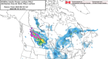
Click here for Environment and Climate Change Canada (ECCC) smoke predictions for next 72 hours (Click the "play" button for animation). Additional maps and modelling can be found at the Air Quality Model Forecast page.
Another resource is the Firesmoke Canada page.
CANWARN New Brunswick
CANWARN involves an active group of people that spot and report on severe weather. It was originally formed as a network of weather-trained ham radio operators across Ontario, and has since spread to Alberta, Saskatchewan, Manitoba, Quebec, and into Atlantic Canada. The network now includes a growing team of other formally trained severe-weather spotters, from members of the Canadian Red Cross to government and provincial park staff.
Outlook for 2025 hurricane season (bilingual video)
With June 1 being the official start of the hurricane season, The Canadian Hurricane Centre (CHC) provided a media update on the upcoming season. Included in the May 23 presentation is meteorologist Bob Robichaud (VE1MBR) with Enviroment and Climate Change Canada at the CHC. This is a link to the video presentation in both official languages (run time about 45 minutes).
Weather Net ends 2024-2025 season
The IRG Weather Net held its last daily net for the 2021-2022 season on Friday, April 11. Since November 4, observers contributed an estimated 23,000 items of data to help Environment Canada, N.B. River Watch, and other agencies in their forecasting.
IRG Weather Net to start for season on November 4
Hey, weather watchers! Dust off those snow boards, metre sticks and thermometers, because the IRG Weather Net will start for the 2024-2025 season on Monday, November 4, 2024 and run every morning at 7:30 a.m. Atlantic Time. Net control will be shared by Rick VE9MTB and Scott VE1CSA. They will gather your local observations and send them off to Environment and Climate Change Canada. ECCC uses the reports to fine tune their predictions and issue alerts in severe weather conditions. The reports are also used by other agencies such as River Watch and news media.
Win a LaCrosse weather station
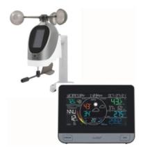
Update! The winner of the draw for the new LaCrosse weather station was VE9GM, Gino Mazerolle of Drummond, NB. Congratulations, Gino! Thanks to all who participated, and keep on providing those observations.
To celebrate the 30th Anniversary of the WeatherNet, Scott VE1CSA and Rick VE9MTB want to thank everyone who’s checked in over the years allowing the reporting of over 600,000 pieces of data to the Atlantic Storm Prediction Center.
2022 Atlantic hurricane season outlook
Bob Robichaud (VE1MBR), Warning Preparedness Meteorologists for Environment and Climate Change Canada, presents the outlook for the 2022 hurricane season in Canada.

