
Hey, weather watchers! Dust off those snow boards, metre sticks and thermometers, because the IRG Weather Net will start for the 2023-2024 season on Monday, November 3, 2024, and run every morning at 7:30 a.m. Atlantic Time. Net control will be shared by Rick VE9MTB and Scott VE1CSA. They will gather your local observations and send them off to Environment and Climate Change Canada. ECCC uses the reports to fine tune their predictions and issue alerts in severe weather conditions. The reports are also used by other agencies such as River Watch and news media.
You might ask, "But don't I need a fancy electronic weather station??" Not at all - simple manual observations are fine. In fact, manual precipitation reports are more reliably done using simple gauges, and in most cases, snowfall can only be reliably measured by real humans. Visibility and other observations you provide can tell the story that even ECCC's remote electronic stations do not.
Here are the observations we look for in your report (and if you give it this order, it helps the net controller a lot!). There are also some suggested standard phrases shown which you can use which makes our reports more accurate. Remember, the more accurately and clearly you give your report, the more likely the net controller can record it correctly the first time.
- Cloud cover (or "Sky") Cloud cover should be reported in tenths, i.e. zero to ten. For example if half the sky is covered with cloud, report it as for example, "Sky is five" (as in 5/10ths.) "Sky is Zero" is no clouds (clear sky), and "Sky is Ten" is completely overcast.
- Precipitation (or "Current Weather") Examples: "Light rain", "Heavy snow", "Drizzle" etc. If there is no current precipitation at time of observation, report "No active weather". If you are unsure of the precipitation type just make your best guess.
-
Obstruction to Visibility - ("Visibility") Report the visibility in miles, from zero to six. Examples: "Visibility is 3 in fog" or "Visibility less than one in drizzle". If visibility is unlimited, say "Visibility six plus". In some cases, you might be able to narrow it down to "Visibility only 100 metres in heavy snow." If conditions are changing rapidly, report this and the net controller will add it to the comments for your area.
-
Current temperature: ("Temperature") Report whatever your thermometer reads at observation time (around 7:30 a.m.) Example: "Temperature is twelve decimal five". Rounding off is fine, but you don't need to. Make sure your thermometer is placed in an area about five feet above ground, preferably in an area with good air flow and shaded from direct sun and away from any walls or pavement that might radiate heat.
-
Precipitation Amounts ("Precipitation" or "Rain" or ""Snow") Report liquid amounts in millimeters and solid amounts in centimeters for last 24 hours ending around 7:30 a.m. Examples: "Precipitation was snow, twelve centimeters" or "Rain was Five decimal five millimeters". It can indeed get complicated where rain mixes with snow, so just use your best judgement or report both types if you have those measurements. Remember - it is the last 24 hours at net time we are looking for. See the caution below about "Yesterday" data from electronic weather stations.
Some excellent videos on measuring and reporting precipitation can be found at cocorahs.org . -
Wind Direction and Speed ("Wind") Report the average speed in kilometers per hour if possible, but if you are reporting in miles per hour, knots or Beaufort scale, be sure to indicate if other than km/hr. Specify the direction, the eight points of the compass are close enough, such as "West" or "South-East" .
Some example reports: "Wind North 20" would mean 20 km/hr average speed. If you have any significant gusting winds, estimate them, and report in the format, "Wind North 20, gusting to 50" for example.
To help estimate or convert wind speed, you can use the Beaufort Scale chart at this link. Where possible, please report in km/hr. Otherwise, be sure to tell us the units you are using and we will do the conversion to km/hr.
-
Maximium / Minimum Temperature ("High and Low" or "Gradient") Report the maximum and minimum temperatures in the last 24 hour period if you have this ability. See the caution below about "Yesterday" data from electronic weather stations.
-
Other comments: If you have other significant things to report about the last 24 hour weather, leave that to the end of the other observations and we will add it to the report. Example: "We had a short thundershower yesterday at 4:00 pm" or "The snow changed to rain about 6:00 a.m."
Any and all reports welcome
If you are new, just jump right in and you will get lots of help, you'll catch on pretty fast. It's not rocket science, and we welcome any reports, even if it's just the sky cover or snow depth for your area every now and then if you happen to be around.
Some helpful tips
Having the information in this same order as the Net Controller form is especially helpful. This will make it easier and quicker for the Net Control Station (NCS) to record the information and pass it on to the forecast office. Using codes is not necessary, plain language is encouraged by participants. Report your data slowly enough and with pauses that the net controller can keep up.
It's always a good idea to start with "Here is the report from ... (your location) ". This allows the NCS to know where to put the data, and remember, we have lots of listeners out there who "want to know!"
We do not routinely record barometer, humidity or any other observations not listed above, but if you do wish to report them for information, report them at the end of all the other data, and the net controller may report them as comments in the report if significant.
Remember, the net control station is using a form and marking down your data, either on paper or computer screen. Giving your observations in the same order as on his / her form really, really helps and will avoid errors, and avoid having to repeat the information. It's also helpful to state the parameter, then the data, such as "Rainfall in last 24 hours, 25.5 mm" instead of "We had 25.5 mm of rain". This gives the net controller a "heads-up" of where to start entering the data, instead of trying to remember the number 25.5 AND THEN finding the place to put it.
Special note to those using automatic or electronic weather stations with "Yesterday" data:
When you report for the Weather Net, we are looking for data for the last 24 hours ending at net time, at or about 7:30 am. Note that many electronic weather stations might display "Yesterday" data. "Yesterday" may actually be a period from midnight to midnight for the previous calendar day, not the last 24 hours. Some stations allow you to change the default reset time. If you can, change your station to reset just before the Weather Net so your "yesterday" high and low temperatures, rainfall, etc is actually data reflecting the last 24 hours at net time. Some stations may have a separate display for "Last 24 hours", so use that data instead of "Yesterday". In any case, let the net controller know if the data is not the last 24 hours as of net time.
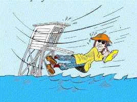
Be safe and enjoy the weather!
Most of all, don't put yourself in any danger to get measurements if the weather is too severe for you to venture out. Whatever you can report from the "warm side of the glass" will be fine.